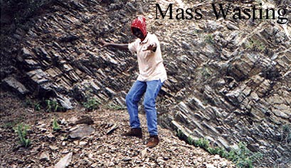
Judgement Cliff Landslide, St. Thomas Parish, Jamaica
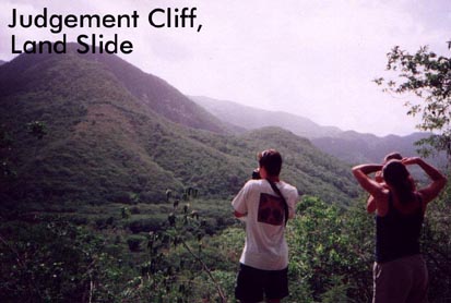
Judgement Cliff landslide is described by Ahmad, R. (1998, "Physical environment and geohazards in Kingston, St. Andrew and St. Thomas, Jamaica," Fifteenth Caribbean Geological Conference, Articles, Field Guides, and Abstracts, Donovan, S.K., ed., Contribution to Geology, UWI, #3) as follows:Figure 1 (below) is a geological map and cross-section of the Judgement Cliff landslide. Judgement Cliff landslide is a complex rock slide-slump, with a volume of approximately 6.6 x 10⁶ m3, located in the lower Yallahs valley in St. Thomas. It is one of the largest and most spectacular landslide landforms in Jamaica and was first described by Zans (1959). Landslide scars may be seen along the entire length of the eastern slope of the valley in this area. However, Judgement Cliff is prominent because of the bare upper scarp slope and landslide debris forming a prominent conical hill. The landslide deposits are stacked in the form of thrust sheets. The slip surface lies within a zone of clay and shales with some gypsum at the base of Tertiary limestones.According to Zans (1959), the landslide occurred in 1692 and was either triggered by the 6th June Port Royal Earthquake or immediately followed the earthquake during a period of hurricane rainfall. Dr. Hans Sloane described the landslide in 1809 ( in Zans, 1959, p. 43) as follows: "At Yellows a great mountain split, and fell into the level land, and covered several settlements, and destroyed 19 white people. One of the persons, whose name was Hopkins, had his plantation removed half a mile from the place where it formerly stood."
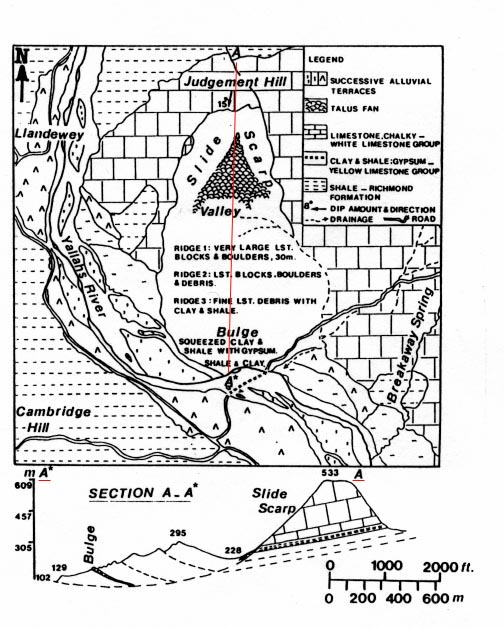
Figure 1. Geological map and cross-section of the Judgement Cliff Landslide. Modified and redrawn from Zans (1959). In the small cross-section beneath the geologic map, note the lesser peak of elevation 295 m. This was the former peak of Mt. Sinai. Note the depression between the landslide deposit and the present peak of Mt. Sinai, at the base of the slide scarp. Depressions of this sort are commonly associated with major slides and may be identified by depression contours on the topographic map.
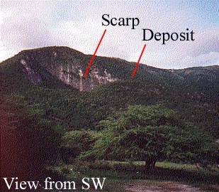
Figure 2. Judgement Cliff from the SW. Note top of deposit (red pointer). This was originally the top of Judgement Hill, also known as Mt. Sinai.
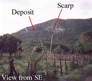
Figure 3. Judgement Cliff from the SE.

1. For the Judgment Cliff landslide, outline and label on the topographic map:a. The scarp surface.
b. The slide deposit.c. The intervening depression.
2. Construct a topographic profile along the segment A-A'. Label the different parts of the profile (i.e., scarp, slide deposit, depression).
3. Combining the information in the small profile (beneath the geologic map) and in your topographic profile reconstruct the original profile of Mt. Sinai (prior to the 1692 earthquake). I.e., sketch onto the profile the original position of the transported material.4. Examine the topographic map, and find another major landslide. (Hint: The slide can be found along grid line 385000N.)
a. What is the evidence for the slide?b. Outline and label, on the map, relevant features of the slide (i.e., the slide deposit, the scarp, the depression). The edges of the slide deposit show up particularly well by connecting points of inflection in the contour lines.
c. Give the grid coordinates for the highest point on the slide deposit.d. Construct an E-W topographic profile across the landslide.
e. In the profile, try to project the original land surface beneath the slide deposit, i.e., on the profile, with a dashed line, show approximately the bottom surface of the slide deposit.
5. Compare the profiles for the two landslides. Factors you should discuss include (1) the steepness of the scarp, (2) the difference in the elevation between the top of the deposit and the bottom of the depression, and (3) the thickness of the deposit. Offer an explanation for any obvious differences. (Hints: Think in terms of the strength of the material. The Judgement Cliff landslide involves mostly limestone. The second landslide involves mostly shale. What do you know about the strengths of these rock types?)
Designed by R.N. Abbott, Jr., Department of Geology, Appalachian State University, Boone, NC 28608